SYDNEY
AIRPORT GUIDE 
Airport facilities located at each Sydney SYD airport terminalContact details and location of airlines at Sydney SYD airportAirport transfers, taxis and public transport to Sydney SYD airport
Sydney SYD airport map and Sydney area mapBook a hotel near Sydney SYD airport
GETTING THERE
GETTING FROM
AT THE AIRPORT

Sydney Airport Maps and Directions

Sydney Airport Map

Sydney Airport Map


Sydney Area Map

Sydney Area Map


Driving Directions

Sydney airport is about 6 miles (9 km) south of the city center. Travellers are requested to follow the appropriate signs directing them to the required destinations.

Major routes that provide access to the airport include the Eastern Distributor, while minor roads include Marsh Street and O'Riordan Street.

Authorities advise those driving to the airport for the first time, carry the appropriate street directory to avoid delays.
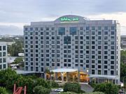
Found this useful? Why not share it with your friends...

Featured Hotels
     
0.5mi from airport
More Info »
     
1.2mi from airport
More Info »
     
4.5mi from airport
More Info »

BOOK FLIGHTS
CAR RENTAL
HOTELS

Email News

Sign up to receive the latest offers

Sign up »


Please note: The term Sydney Airport SYD as well as all associated graphics, logos, and/or other trademarks, tradenames or copyrights are the property of the Sydney Airport authority and are used herein for factual descriptive purposes only. We are in no way associated with or authorized by the Sydney Airport authority and neither that entity nor any of its affiliates have licensed or endorsed us.